
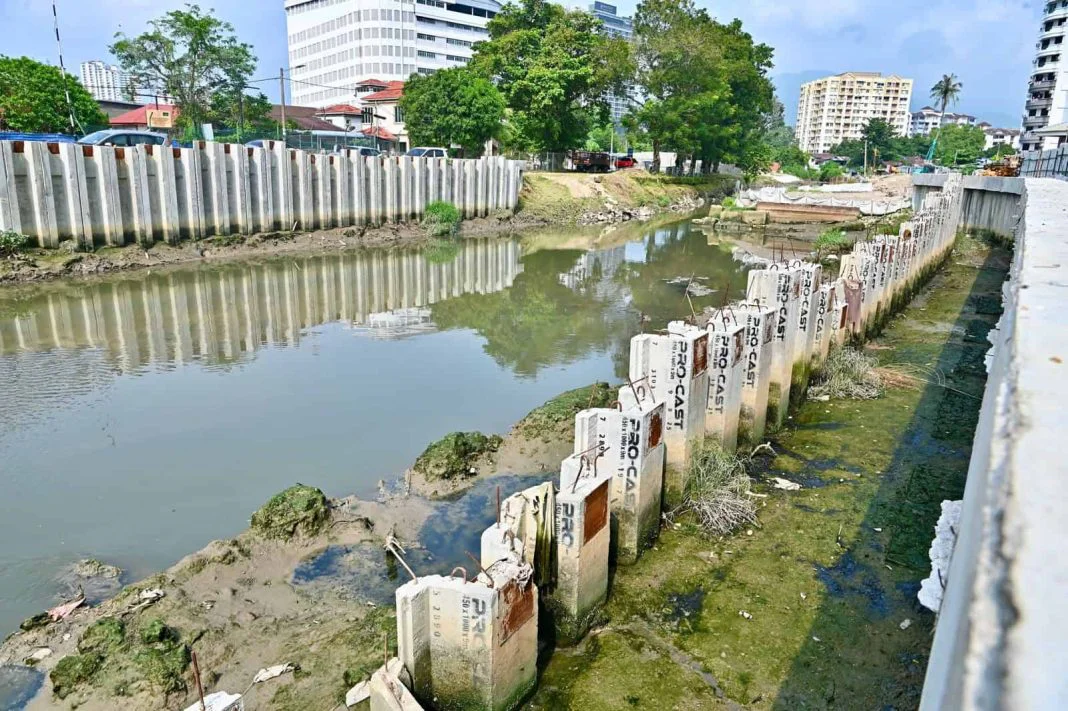
Penang’s RM114.8 million Sungai Pinang flood mitigation project has passed the halfway mark, standing 50.86 per cent complete with full completion scheduled for 20 September 2027, NST reported. State Infrastructure, Transport and Digital Committee chairman Zairil Khir Johari said the progress figure was recorded as at September 2026 and that the works remained on schedule.
The scheme is meant to cut flash flood risk across the 51 sq km Sungai Pinang river basin, where rapid development has put growing pressure on the existing drainage network. “The project is expected to reduce the flood-affected area in parts of the Sungai Pinang basin by 10.15 per cent, while reducing damage to public infrastructure, residents’ properties, housing and transport links,” he said during a visit to Phase One of the river basin flood mitigation plan.
Work started on 21 September 2023 and the scheme is designed to protect against a flood with a 100-year average recurrence interval. Its scope covers deepening and widening a 1.4 km stretch of Sungai Pinang, laying 1.02 km of parallel drains and upgrading drainage outfalls so stormwater reaches the sea faster. It also carries a piano weir and a pumping station fitted with four screw pumps, two on each riverbank and each rated at 2.0 cubic metres per second, according to Buletin Mutiara, the state government’s news outlet. An ancillary building is also being built.
Zairil said new riverbanks had already been laid in several areas, while piling for the pumping station and the piano weir was under way. The visit took place near Balai Rakyat Jalan Patani. Social Development, Welfare and Non-Muslim Affairs committee member Lim Siew Khim, who represents Sungai Pinang, also attended.
An earlier update put the scheme at 24 per cent complete in April 2025. Chief Minister Chow Kon Yeow said at the time that construction of the piano weir and monsoon drain structures at Kampung Jawa was under way, stretching from the Jalan Jelutong bridge to the end of the bridge at Jalan Perak, NADMA noted.
The 3.2 km Sungai Pinang is the main drainage channel for the river basin in Penang’s northeast district and carries its water out to sea. Development across the surrounding catchment has altered land levels and surface water flows, while the old drainage system has struggled to handle higher volumes during heavy rain, raising the risk of flash floods.
Zairil said the scheme was among the state government’s long-term efforts, pushed for close to 20 years before it was finally approved and started under the federal MADANI government. He said the state government would keep monitoring progress so the flood reduction targets were met.
“The project is expected to help minimise flood-related losses and strengthen protection for communities and infrastructure in vulnerable parts of the basin,” he said.